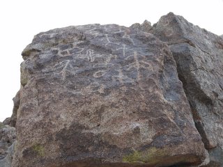
Granite Wash Petroglyphs
 I was playing around on www.flicker.com and found photos by an interesting person who was driving around the South West developing mapping software. His photos are unique in that you can click a link and you'll see a map and coordinates of where the picture was taken. It sounds like a very cool feature for folks that want to include locations with their photos, and I'm sure it has many more applications that I can't even imagine.
I've been doing something similar (but on an elementary level) for some time now. It was killing me to write down coordinates everytime I took a picture, and taking a picture of the GPS screen after photographing a glyph wasn't exactly efficient either. So I thought to myself how cool it would be if I had a GPS that would record my location at various intervals. It was quite a task. Salespeople these days can do little more than read the side of the box to you when you want to know about an item's features. And the feature I was looking for just didn't seem that popular. I went through several high end GPS models before I found what I was looking for. I finally settled on a Garmin GPSmap 60C. This model allows you to record tracks based on time or distance intervals. So what I did was turn on the GPS and let it find the satellites to establish location and time. I imagine the GPS satellites are synchronized with a super-duper-accurate-atomic-clock or something. I then synchronize by computer's time to that of the GPS via a USB cable, then I would synchronize my camera's clock to my computer. It seems like the long way to do something, but now my camera and GPS are synchronized. Then I set my GPS to record my location every 30 seconds or so and turn it on at the beginning of a hike. Later I go home and download the recorded positions and photos onto my computer. Then if I ever want to know where a picture was taken, I can take the date and time from the pic, and compare it to the list of locations, and see the coordinates of where I took it.
There's software out there that will take all that info, and superimpose the coordinates on the picture for you, but it sells for something like two hundred bucks! No way! It's funny how I'll pay $450 for the GPS I want, $600 for the camera I want, but won't part with $200 to make my life a little easier!
I showed this neat little trick to some of the mouth-breathers at the AAS Rock Art Recording School. Some oooh-ed and awww-ed, some were indifferent, and others called me a heretic and threatened to burn me at the stake lest I steal their soul with my wizardry. I think it's important to point out that some of these folks were still wanting to record glyphs the old way, by photographing them on 35mm black and white film. I'm having less and less to do with the AAS these days in case you haven't guessed.

0 Comments:
Post a Comment
<< Home